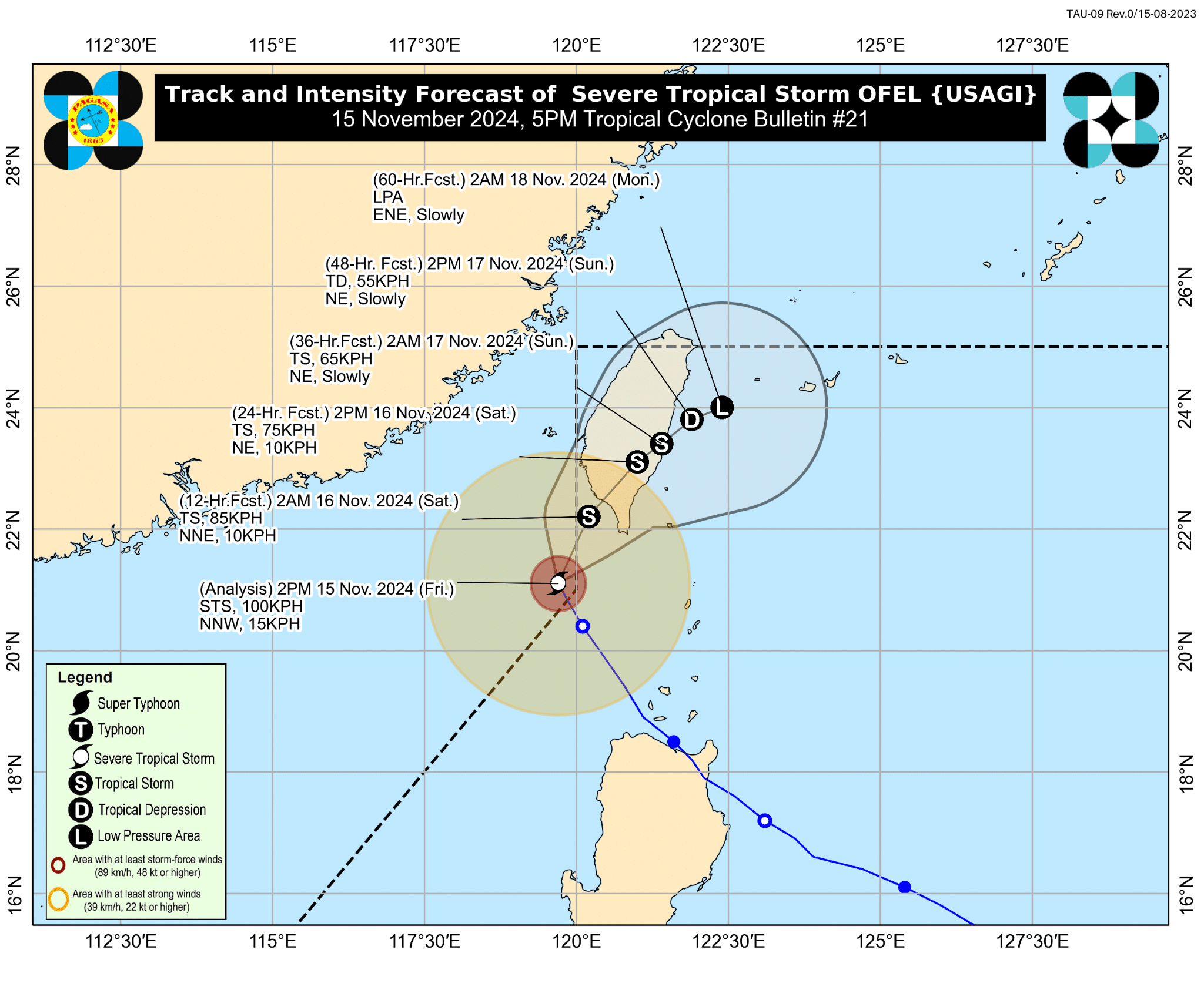

Track of Severe Tropical Storm Ofel IMAGE: DOST / Pagasa
MANILA, Philippines — Severe Tropical Storm Ofel (international name: Usagi) left the Philippine area of responsibility (PAR), according to the country’s weather agency.
READ: LIVE UPDATES: Typhoon Pepito
Article continues after this advertisementIn its 5 p.m. bulletin, the Philippine Atmospheric, Geophysical and Astronomical Services Administration (Pagasa) last spotted Ofel at 205 kilometers (kms) west-northwest of Itbayat, Batanes.
FEATURED STORIES NEWSINFO Super Typhoon Pepito now approaching landfall in Catanduanes NEWSINFO LIST: Areas at high risk of storm surge due to Super Typhoon Pepito NEWSINFO Pepito’s ‘eye’ passing the vicinity of Panganiban, Catanduanes

Image from DOST / Pagasa
It was moving north-northwestward at 15 kms per hour (kph), packing maximum sustained winds of 100 kph and gustiness of 125 kph.
Pagasa, however, said that Ofel may reenter PAR by curving toward the sea southwest of Taiwan either Friday evening (Nov. 15) or Saturday early morning (Nov. 16).
Article continues after this advertisementREAD: Pagasa issues upgraded rainfall warning as Pepito approaches Luzon
Article continues after this advertisementThe state weather bureau only retained the Tropical Cyclone Wind Signal (TCWS) No. 1 in Batanes province.
Article continues after this advertisementPagasa added that the cyclone may make landfall in southwest Taiwan on Saturday (Nov. 16) and cross into the sea east of Taiwan on Sunday (Nov. 17).
The severe tropical storm will be downgraded to a remnant low either Sunday evening (Nov. 17) or Monday early morning (Nov. 18).
Subscribe to our daily newsletter

